
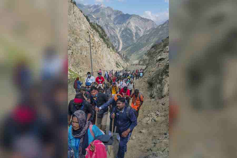
Nearly 85 per cent of the Amarnath pilgrimage corridor is vulnerable to landslides, a new study shows. Researchers found that 16.2 per cent of the 35km route is highly susceptible. Intense rainfall, weak rocks, and road work triggered 49 landslide events, posing serious risks to the many pilgrims visiting annually.
A study identifies 16.2% of the 35km route as highly susceptible and 68.1% as moderately susceptible, with intense rainfall, weak rocks and road work raising risks
Nearly 85 per cent of the area along the Amarnath pilgrimage corridor in Jammu and Kashmir is susceptible to landslides, with steep slopes, weak geological formations, road construction and extreme rainfall events contributing to slope instability.
A hazard assessment exercise by researchers at the National Institute of Hydrology (NIH) in Jammu and other institutions has classified 16.2 per cent of the study area along a 35km Baltal-Amarnath-Panjtarni-Pothpathri corridor as "highly susceptible" and 68.1 per cent as "moderately susceptible" to landslides.
Their analysis has found that extreme rainfall events, including cloudbursts and intense monsoon downpours, are major triggers for debris flows, rockfalls and flash floods, particularly in those areas where the underlying rocks are weak or fractured.
"We wanted to understand the geological, structural and climatic conditions that trigger landslides and identify the most vulnerable stretches along this pilgrimage corridor," Riyaz Ahmad Mir, a geoscientist with the NIH who led the study published in the journal Scientific Reports,
told The Telegraph.
The Amarnath cave at an altitude of about 3,800 metres (12,000 feet) has attracted between 3,00,000 and 4,00,000 pilgrims annually during most years over the past two decades. Debris flows and a localised flood near the cave after a cloudburst on July 8, 2022, had claimed at least 16 lives.
Mir and his colleagues from the Geological Survey of India and other institutions evaluated the landslide-prone areas by examining 18 factors, including geology,
slope, drainage patterns,
snow and rainfall and human activities such as road construction.
Their assessment showed that the map could identify vulnerable locations with a high degree of reliability when tested against independently recorded landslides.
Field investigations documented 49 landslide events along the corridor, comprising 28 debris flows, 15 rockfalls, two debris slides, two rockslides, one instance of slow ground movement and one rock topple.
The study found that 60 to 70 per cent of the recorded landslides occurred within 50 metres of roads and other infrastructure, while slopes steeper than 25 degrees accounted for nearly 90 per cent of mapped slope failures.
Weather observations from 1980 to 2024 showed
that the region's average annual temperature had increased by an estimated 0.0512°C a year or roughly 2.3°C over
the period.
Satellite observations also revealed fluctuations in annual snow cover, from 80.2 per cent of the study area in 2018 to just 25.9 per cent in 2020, before recovering to 71.1 per cent in 2022 and declining to 51 per cent in 2024.
With snow cover falling to just 0.4 per cent in August, the researchers suggest that heavy monsoon rainfall, rather than snowmelt, is the dominant trigger of slope instability during the pilgrimage season.
They identified 54 instances of extreme rainfall events exceeding 45mm in a day in the Baltal Valley between 1994 and 2024, including 15 during the monsoon season.
Intense rainfall and cloudbursts can rapidly saturate slopes, mobilise loose debris and trigger landslides and flash floods, particularly in steep areas with weakened rocks.
"Under the increasing frequency of extreme rainfall events during recent years in the western Himalayan states, including Jammu and Kashmir, we could expect a
heightened risk of landslides in this vulnerable area," said Mir.
The researchers recommend better drainage, slope stabilisation, stricter geological assessments before road construction and the relocation of temporary accommodation away from highly vulnerable areas.
They have also called for continuous rainfall monitoring and regular updates of landslide-prone area maps to strengthen early-warning systems and protect pilgrims and infrastructure.