
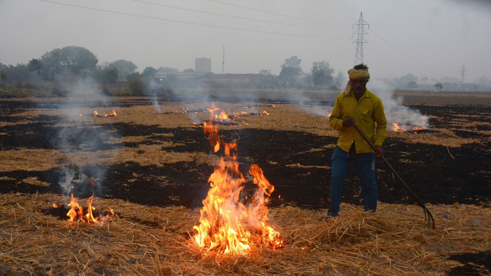
Punjab recorded a 23.5% decline in stubble burning area between September 15 and November 15. Although fire incidents spiked by 22.4%, the actual land affected fell significantly. Officials said farmers now use partial burning, which increases fire counts but reduces the total area burnt across many of the state's districts.
Even as Punjab has recorded a sharp increase in paddy-residue fire incidents this season compared to last year, the actual agricultural area affected by stubble burning has declined by 23.5 per cent, revealing a significant divergence between the number of fires detected and the extent of land burnt.
A district-wise analysis of satellite-based burnt-area data, compiled through the Punjab Pollution Control Board (PPCB), for the period September 15 to November 15 shows that the cumulative burnt area across Punjab fell from 19.41 lakh hectares in 2025 to 14.84 lakhhectares this year. This represents a net reduction of 4.57 lakh hectares.
The decline was widespread, with 21 of Punjab's 23 districts registering a reduction in burnt area. Only two districts recorded an increase, both marginal. SAS Nagar saw its burnt area rise from 19,870 hectares last year to 21,780 hectares this year (an increase of 1,910 hectares, or 9.6 per cent), while Hoshiarpur recorded a marginal increase of 0.24 thousand hectares (0.8 per cent), from 31,740 to 31,980 hectares.
The reduction in affected acreage comes despite a substantial increase in fire detections. Between September 15 and November 15, the state recorded 5,972 farm-fire incidents, up 22.4 per cent from 4,877 during the corresponding period in 2025. The gap widened further over the next four days: by November 19, the cumulative number of incidents had reached 6,874, compared to 5,034 last year -- a jump of 36.5 per cent.
Agricultural officials say one reason for the divergence could be a change in the extent of burning within individual fields. In some instances, farmers resort to partial burning of crop residue instead of setting entire fields on fire. Such instances are counted as individual fire incidents in satellite-based fire detection, irrespective of how much of the field is actually affected. Consequently, a higher number of fire detections does not necessarily translate into a proportionate increase in the total area burnt, added sources.
PPCB sources said the two parameters capture different aspects of stubble burning: fire incidents indicate the number of detected ignition events, while burnt-area mapping helps assess the geographical extent of land affected. The latter, therefore, provides an important additional measure for understanding the actual spread of burning across agricultural fields.
The distinction is significant for this year's figures. Despite the increase in the number of fire incidents, the satellite-based assessment shows that the overall burnt footprint has contracted substantially, suggesting that the fires have not translated into comparable increases in the area affected.
Major gainers and laggards
Among Punjab's major paddy-growing belts, Ferozepur recorded the steepest absolute reduction in burnt area, with a decline of 61,320 hectares, from 1.36 lakh hectares in 2025 to around 75,000 hectares this year. Sangrur, traditionally a major hotspot, followed with a reduction of 53,450 hectares, from 1.84 lakh to 1.31 lakh hectares, while Moga recorded a decline of 51,770 hectares, from 1.08 lakh to 56,690 hectares.
Bathinda and Barnala completed the top five districts in terms of absolute reductions, with burnt areas declining by 41,990 hectares (from 1.25 lakh to 83,270 hectares) and 36,700 hectares (from 82,007 to 45,370 hectares), respectively.
In percentage terms, Moga led the state with a 47.7 per cent reduction in burnt area, followed by Ferozepur (45.0 per cent), Barnala (44.7 per cent), Pathankot (44.0 per cent) and Mansa (42.4 per cent).
Faridkot, too, recorded a 28 per cent reduction in burnt area, from 56,830 hectares to 41,000 hectares this year.
However, the improvements were not uniform across the state, with several districts recording only modest reductions. Gurdaspur's burnt area declined by just 2.2 per cent, from 1.03 lakh hectares to one lakh hectares.
Kapurthala recorded a 3.1 per cent reduction (75,330 to 73,030 hectares), Fazilka a 6.0 per cent decline (34,440 to 32,350 hectares), and SBS Nagar an 8.6 per cent reduction (31,002 to 28,350 hectares).
The bigger picture
The reduction assumes added significance when viewed against the scale of paddy cultivation in Punjab. The state's total rice acreage stood at 32.87 lakh hectares this year, of which around 26 lakh hectares was under paddy (non-Basmati), with the remaining area under Basmati. Satellite imagery had recorded 29.54 lakh hectares by November 15, leaving the final 15 days of the monitoring period, which runs from September 15 to November 30, still to be accounted for.
Sangrur accounted for the largest share of the state's rice acreage at 2.36 lakh hectares, followed by Ludhiana (2.25 lakh hectares), Patiala (2.13 lakh hectares) and Bathinda (2.08 lakh hectares).
The November 15 figures, therefore, offer a comparative picture of the extent of burning so far, rather than the final seasonal assessment. Both farm-fire incidents and burnt-area data continue to be monitored through November 30, and the remaining 15 days could add to the cumulative figures.