
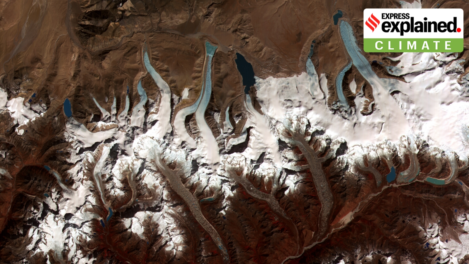
A glacial lake outburst flood occurs when water dammed by a glacier is released suddenly. The 2023 Sikkim disaster killed 55 people, showing the region's vulnerability. As glaciers melt, new lakes form and grow. Experts said, "Risk reduction has to begin with identifying and mapping such lakes," to save lives.
A glacial lake is a large body of water that sits in front of, on top of, or beneath a melting glacier. A GLOF occurs when the water dammed by a glacier or a moraine (accumulation of debris) is released suddenly. One of the worst GLOFs took place in Sikkim in 2023, killing 55 people.
GLOFs and other Himalayan flooding events — such as the recent Nepal tragedy, the 2013 Kedarnath disaster, the 2021 Chamoli flooding, and the 2025 Dharali mudslide — are reminders of the vulnerability of the region to major disasters. Though they were all triggered by a unique set of circumstances, each of them involved a very large and sudden release of waters in the mountainous rivers.
What are GLOFs, and how vulnerable are the Himalayas to these phenomena?
According to the NDMA, the retreat of glaciers as a result of climate change that is occurring in most parts of the Hindu Kush Himalayas has given rise to numerous new glacial lakes, breaches in which can cause GLOFs.
A GLOF occurs when a large mass of water dammed by a glacier or a moraine is released suddenly. When glaciers melt, the water in these glacial lakes accumulates behind loose naturally-formed “glacial/ moraine dams” made of ice, sand, pebbles, and ice residue. Unlike earthen dams, the weak structure of the moraine dam leads to its abrupt failure, which can release millions of cubic metres of water in a short time, causing catastrophic flooding downstream. Peak flows as high as 15,000 cubic metres per second have been recorded during such events.
Since glaciers in the Himalayas are in a retreating phase, glacial lakes are growing, and pose a potentially large risk to downstream infrastructure and life.
The National Remote Sensing Centre (NRSC) had completed a project during 2011-15 on “Inventory and Monitoring of Glacial Lakes/ Water Bodies in the Himalayan Region of Indian River Basins”, sponsored by the Climate Change Directorate of the Central Water Commission (CWC). It was observed at the time that there were 352, 283, and 1,393 glacial lakes and water bodies in the river basins of the Indus, Ganga, and Brahmaputra respectively.
How can the risks from GLOFs be reduced?
The NDMA guidelines say that risk reduction has to begin with identifying and mapping such lakes, taking structural measures to prevent their sudden breaches, and establishing mechanisms to save lives and property in times of a breach.
According to the NDMA, potentially dangerous lakes can be identified on the basis of the condition of lakes, dams, associated mother glaciers, and topographic features around the lakes and glaciers.
The identification of these lakes are based on field observations, processes and records of past events, geomorphological and geotechnical characteristics of the lake/ dam and its surroundings, and other physical conditions.
NDMA has recommended the use of Synthetic Aperture Radar (SAR) imagery to detect changes in water bodies, including the formation of new lakes, during the monsoon months. It has said that methods and protocols could be developed to allow all-year remote monitoring of lake bodies from space as a complement and a precursor to ground-based early warning systems at critical lakes.
Structurally, the management of the situation requires a reduction in the volume of the water in the lake. This can be done through controlled breaching, the construction of an outlet-control structure, pumping or siphoning out the water from the lake, and making a tunnel through the moraine barrier or under an ice dam.
One such landslide that occurred along the Phuktal river, a tributary of the Zanskar river, on December 31, 2014 about 90 km from Padum in Kargil district of Ladakh, led to the blockage of the river and eventually a potential flood situation on May 7, 2015.
Why are such floods occurring repeatedly? How much is climate change responsible?
Climate change is altering the conditions in which Himalayan hazards develop, but it does not establish the cause of any individual flood.
As temperatures rise, glaciers lose mass and retreat. The space left behind can form depressions where water accumulates. Some of these lakes are held back by moraines — deposits of sand, silt, gravel and boulders left by glaciers.
P D Pant, director of the School of Earth and Environmental Science at Uttarakhand Open University, earlier told The Indian Express that when a glacier retreats, a lake can form in the space left behind. He also explained that a moraine is not solid bedrock but a barrier composed of loose material.
Because such barriers can be vulnerable to erosion and failure, a sudden influx of water, overtopping or a breach can release a large volume of water downstream.
Pant also pointed to the role of prolonged or intense rainfall. If water accumulates in a lake or behind a landslide obstruction, it can contribute to a sudden release.
In areas where ice helps bind material together, changes in temperature and melting can make slopes more susceptible to failure.
Pant said climate change was the biggest factor behind retreating glaciers.
Scientific research, including assessments by the Intergovernmental Panel on Climate Change, has documented glacier loss across the Hindu Kush Himalaya and other mountain regions. This supports the conclusion that warming is changing the physical environment in which mountain hazards occur.