
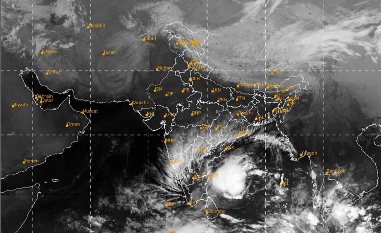
A new storm is brewing in the Bay of Bengal and could become a very severe cyclone by November 19. This follows Cyclone Arnab on October 28 and Cyclone Murasu on November 2. Officials said the system is being monitored closely as it moves towards the Andhra Pradesh coast.
Market Mastery
Webinar by Vishal Malkan
Find the weak links
in your portfolio by Vishal Malkan
Just two weeks after Cyclone Murasu crossed the Andhra Pradesh coast near Ongole, another storm is brewing in the Bay of Bengal, and it could follow a similar path.
A depression over the southeast and southwest Bay of Bengal is gathering strength and is expected to become a cyclone on Monday, before growing into a very severe cyclonic storm over the next four days, according to a special bulletin issued on Sunday by the Regional Meteorological Centre (RMC) in Kolkata.
Its track is not yet clear, but weathermen say it could move towards the Andhra Pradesh coast. If it does, it will be the third cyclone to hit the state in less than three weeks, after Cyclone Arnab on October 28 and Cyclone Murasu on November 2.
Once it forms, the cyclone will be named Akvan, a name suggested by Iran.
Cyclones in the north Indian Ocean are named in turn from a list contributed by the countries in the region, and Akvan is the next name due.
How strong will Cyclone Akvan get?
Meteorologists expect the system to keep moving north-northwestwards and strengthen in stages:
November 16: Becomes a cyclonic storm over the central parts of the south and adjoining west-central Bay of Bengal
November 17: Strengthens into a severe cyclonic storm over the west-central Bay of Bengal
November 19: Escalates into a very severe cyclonic storm, with sustained winds of 120-130 kmph gusting up to 145 kmph
That would make Akvan stronger than Murasu, which crossed the coast as a severe cyclonic storm with winds of 100-110 kmph.
Under the cyclone’s influence, Kolkata and south Bengal may get light rain from November 18.
The showers may gain intensity on Nov 19 and 20, but heavy rain is not yet predicted. Coastal areas of south Bengal are likely to receive heavier rain but the intensity can’t be predicted till the cyclone pathway can be predicted more clearly.
The RMC has issued no weather warnings for Bengal up to November 18, but officials said the system is being monitored closely, and its outer bands are expected to change the weather later in the week.
Why so many cyclones in Bay of Bengal?
The Bay of Bengal is one of the world’s most cyclone-prone basins, and October to December is its busiest stretch. After the southwest monsoon withdraws, the sea surface stays warm, often above 28°C, the temperature that fuels cyclones. At the same time, the strong upper-level winds that can tear storms apart during the monsoon weaken, giving low-pressure systems the calm conditions they need to organise and grow. The Bay’s shape, a funnel enclosed by land on three sides, also tends to steer these storms towards the coasts of Andhra Pradesh, Odisha, West Bengal and Bangladesh.
Back-to-back cyclones happen when these conditions stay favourable for weeks at a stretch. A passing cyclone usually cools the sea surface along its path by churning up colder water from below, but the Bay recovers quickly, and fresh low-pressure systems can form in warmer patches nearby. Large-scale atmospheric patterns that travel around the tropics can also boost storm activity over the Bay for a few weeks at a time, which is why cyclones sometimes come in clusters, as they have this season.