
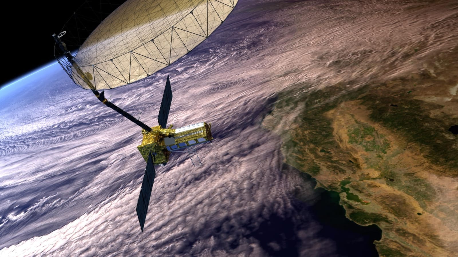
The $1.3 billion NISAR satellite detected precursory movement before the August 26 Nepal disaster, but no one watched the data. Experts said, "detecting danger is one thing; continuously monitoring and interpreting enormous volumes of satellite data in real time and issuing a timely warning is quite another." Lessons remain vital.
New Delhi:
The world's single most expensive civilian Indo-US Earth imaging satellite, NISAR, costing $1.3 billion, saw the warning signs in the Nepal Himalayas. But nobody was watching, and hence no warning was issued.
Experts say merely putting what can only be called 'White Elephants' in the sky is not good enough; one needs human intelligence combined with artificial intelligence to accurately issue early warnings. After all, over a billion human lives are at risk in the northern Indian plains, and NISAR still has four years of life left to redeem itself.
The real mystery is why nobody was watching the data as it was beamed down every 12 days. The evidence was embedded in the voluminous data, but neither ISRO nor NASA connected the dots. Here is a plaintive chronicling of the lessons from NISAR's unheard alert.
The devastating Nepal Rasuwa flash flood of August 26 is emerging as a defining lesson for scientists, disaster managers and governments across the Himalayan region. The world's single most expensive civilian Earth observation satellite, the $1.3 billion NASA-ISRO Synthetic Aperture Radar (NISAR) mission, had in fact detected subtle movements in the glacier and rock mass that ultimately collapsed as it was supposed to do. But the signals were only discovered after the disaster, underscoring a hard truth of modern Earth observation: detecting danger is one thing; continuously monitoring and interpreting enormous volumes of satellite data in real time and issuing a timely warning is quite another.
Hence, some are dubbing the 2393 kg NISAR satellite launched on July 30, 2025, from Sriharikota a white elephant in the sky.
The findings come from the first scientific paper published on the Nepal disaster by 12 scientists from ISRO's National Remote Sensing Centre (NRSC), Hyderabad. The study reconstructs the entire chain of events that led to one of the deadliest Himalayan disasters in recent memory and reveals that NISAR had detected "precursory movement" in the mountains weeks before the catastrophic collapse. But no one took heed.
On the morning of August 26, a massive section of glacier ice and permafrost rock detached from a hanging glacier north of Langtang Lirung peak in Nepal at an altitude of about 5,130 metres. The collapse triggered a gigantic rock-ice avalanche that rapidly transformed into a flood and debris flow racing through the Lhende Khola and Trishuli river systems. The resulting devastation spread across a 72-kilometre stretch of river valley, destroying roads, bridges, buildings, tunnels and critical infrastructure in Nepal and along the Nepal-China border trade corridor.
According to figures cited in the latest ISRO study from Nepal's National Disaster Risk Reduction and Management Authority, the disaster had claimed 1,451 lives, while 5,745 people remained missing as of September 21, 2026. Additional fatalities were also reported in the Tibet Autonomous Region of China.
Satellite analysis showed that the initial collapse involved an astonishing 99 million cubic metres of rock and ice. To put that in perspective, the volume was equivalent to about 115 Empire State Buildings crashing down a Himalayan mountainside almost simultaneously.
What made the event so destructive was not merely the size of the collapse but the enormous release of energy. The detached mass plunged about 1,300 metres from the source region to the glacier valley floor before continuing downslope through an additional vertical drop of nearly 870 metres. In total, the debris mass descended roughly 2,170 metres. That immense loss of elevation converted gravitational potential energy into kinetic energy, accelerating and pulverising the rock and ice into a highly mobile mixture of debris, water and meltwater capable of tearing through a narrow valley in minutes.
The paper published in the Journal of Indian Society of Remote Sensing describes how the avalanche travelled nearly 5.9 kilometres along the valley floor, entraining additional snow, glacier ice, rocks and sediments before transforming into a devastating flash flood. Scientists also recorded a secondary landslide about three hours later, which further complicated the disaster by creating a debris-dammed lake.
The latest paper also states that the earthquake signature detected at 8.22 AM Indian time was an acoustic signal of the rock avalanche coming down with a huge impact, and the earthquake did not trigger the rock-ice avalanche.
The most significant scientific revelation, however, comes from NISAR.
The satellite was launched with considerable expectations because of its ability to measure movement of the Earth's surface with extraordinary precision. It has often been described as capable of detecting ground motion down to millimetre scales. Monitoring glaciers, glacier dynamics, land deformation and natural hazards across mountain regions such as the Himalayas is one of its important objectives.
The NRSC study found that NISAR's L-band radar data covering the period from June 20 to August 19, 2026 clearly identified an unstable high-velocity zone exactly where the catastrophic collapse later occurred. The results showed accelerating deformation and creep in the escarpment section before failure. In the final monitoring interval between July 26 and August 19, displacement vectors became larger, more coherent, and spread across much of the eventual collapse zone. Some pixels recorded cumulative horizontal offsets exceeding five metres.
The data effectively captured the mountain moving before it broke apart. But the warning remained buried within the vast ocean of satellite observations.
Researchers note that the unstable zone became obvious when compared with post-disaster imagery. In other words, the signal existed before the event, but it was recognised only through post-facto analysis.
NASA's Jet Propulsion Laboratory in California, in a statement to NDTV, said, "The data from NISAR, including what its instruments have collected in the area of the flooding, has been and continues to be freely accessible to the public via the Alaska Satellite Facility Distributed Active Archive Center and ISRO's Bhoonidhi portal. Users can analyze the data to generally assess the risk of future disasters."
While ISRO has at least done a post-facto analysis, strangely NASA has not done any analysis of its own on the devastating Nepal floods.
That finding highlights perhaps the most important lesson emerging from the disaster. Satellites like NISAR can map vulnerability, identify unstable slopes, and detect accelerating deformation. They can help determine where danger exists and where risk is increasing. What they cannot currently do is predict the exact moment a glacier or mountain slope will collapse.
The challenge is compounded by scale. The Himalayas stretch across thousands of kilometres and contain 25,000-plus glaciers, hanging valleys, unstable rock faces and permafrost zones. Monitoring every square kilometre continuously would require enormous computing power, advanced artificial intelligence tools and round-the-clock analysis systems capable of processing radar imagery almost in real time.
Scientists also found evidence that climate change may have contributed to the disaster. Using satellite data, they determined that the summer of 2026 was exceptionally warm. Air temperatures remained significantly above the long-term average from 2001 to 2025 and frequently approached or exceeded one standard deviation above normal conditions. Daily temperatures reached between 8 and 9 degrees Celsius, making 2026 one of the warmest years in the 26-year record for the region. Such sustained warmth would have increased glacier melt, generated more meltwater and destabilised slopes already under stress.
The researchers argue that the Nepal disaster is unlikely to be an isolated event. They warn that warming temperatures, melting glaciers and unstable mountain slopes are creating conditions for more such cascading hazards across the Himalayas. Previous disasters, including the Chamoli rock-ice avalanche in Uttarakhand in 2021, pointed in the same direction. The Nepal catastrophe now strengthens the evidence that these events may become increasingly common in a warming world.
For ISRO and disaster management agencies, the study offers a powerful roadmap for the future. The answer is not simply launching better satellites. NISAR has already demonstrated that it can see the warning signs. The next step is building systems capable of continuously monitoring the entire Himalayan region, automatically flagging unusual glacier movements, identifying accelerating creep, and integrating satellite observations with climate, geological, and seismic data.
The Rasuwa flood has shown that satellites can reveal vulnerability. They can identify mountains that are becoming unstable. But predicting exactly when a glacier will break apart and unleash a deadly flood remains beyond the current capability of these eyes in the skies; one needs ground monitoring stations for that.
The world's single most expensive Earth imaging satellite saw the mountain move. The challenge now is ensuring that scientists are watching and offering a precise warning when it does. Bitter lessons were learned since NISAR flagged unusual changes in Nepal's Himalayas. Why did the alarm not ring remains a billion-dollar burning question.