
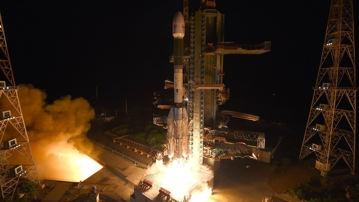
ജിഎസ്എൽവി-എഫ്18 ദൗത്യത്തിലൂടെ എൻവിഎസ്-03 ഉപഗ്രഹം വിജയകരമായി വിക്ഷേപിച്ച് ഐഎസ്ആർഒ. ഇന്ത്യയുടെ തദ്ദേശീയ നാവിഗേഷൻ സംവിധാനമായ നാവിക് (NavIC) കൂടുതൽ ശക്തമാക്കാൻ ഈ നേട്ടം സഹായിക്കും. വെറും 56 ദിവസത്തിനുള്ളിൽ മറ്റൊരു വിക്ഷേപണം കൂടി പൂർത്തിയാക്കി ഐഎസ്ആർഒ ചരിത്രം കുറിച്ചു. സുരക്ഷാ മേഖലയിലും സാധാരണക്കാരുടെ നാവിഗേഷൻ സേവനങ്ങളിലും ഈ ഉപഗ്രഹം നിർണായകമാകും.
The Indian Space Research Organisation (ISRO) successfully launched the GSLV-F18 mission at 11:51 PM IST on October 30, 2026, placing the next-generation navigation satellite NVS-03 into its designated Geosynchronous Transfer Orbit.
Lifting off from the second launch pad at the Satish Dhawan Space Centre in Sriharikota, the 50-metre-tall launch vehicle completed its automated flight sequence in under 19 minutes. The mission marks the 20th flight of India’s Geosynchronous Satellite Launch Vehicle and achieved a record operational turnaround time of just 56 days following the GSLV-F17/EOS-05 launch.
The successful mission represented far more than another satellite launch, marking a crucial step toward securing India's strategic infrastructure. As the twelfth satellite in the Indian Regional Navigation Satellite System (IRNSS) and the third in its second-generation fleet, the spacecraft — alternatively designated IRNSS-1L — is engineered to augment the constellation with enhanced capabilities, greater robustness, and improved reliability for NavIC, India's native alternative to the American GPS.
Prime Minister Narendra Modi hailed ISRO's latest achievement. "This mission marks an important step in strengthening NavIC, our indigenous satellite navigation system. Equipped with enhanced capabilities, NVS-03 will further our pursuit of self-reliance in critical technologies and support navigation services that benefit our people. The dedication and ingenuity of our space scientists continue to make our nation proud," he wrote in a post on X (formally twitter).
What GSLV-F18 accomplished
The three-stage GSLV-F18 rocket, weighing 420 tonnes at lift-off, delivered the 2,250 kg NVS-03 spacecraft into an elliptical orbit measuring 170.3 km at perigee and 38,080 km at apogee. Following successful payload separation, ground controllers confirmed that the satellite's solar arrays deployed as intended and onboard system telemetry remained nominal.
ISRO will perform a series of orbit-raising manoeuvres over the coming days using the spacecraft's onboard propulsion system to transfer NVS-03 from its initial elliptical insertion to its final operational geostationary slot. Data relay operations from the satellite are expected to begin within a week.
Key specifications of the NVS-03 payload
What is NavIC?
NavIC (Navigation with Indian Constellation), officially designated as the Indian Regional Navigation Satellite System (IRNSS), is an autonomous regional satellite navigation network designed and operated by ISRO.
Positioned in high-altitude Geostationary (GEO) and Geosynchronous (GSO) orbits (36,000 km), the system delivers real-time positioning, timing, and navigation services across the Indian landmass and an extended buffer zone stretching up to 1,500 km beyond the nation's borders.
Why the NVS-03 mission matters
NVS-03 is the third satellite in India’s second-generation navigation fleet, designed to bolster and restore capabilities within the Navigation with Indian Constellation network. The spacecraft incorporates an indigenously developed Rubidium atomic clock alongside external timing units to ensure high-precision positioning, navigation, and timing services across commercial and defense applications.
Strategic independence: India commissioned NavIC to build national autonomy in positioning, navigation, and timing infrastructure, eliminating reliance on foreign networks like GPS, GLONASS, or Galileo during critical or hostile situations.
Dual-frequency atmospheric correction: By broadcasting across dual bands (L and S frequencies), NavIC directly measures ionospheric delay rather than relying on mathematical estimation models, improving signal precision in dense vegetation, urban corridors, and mountainous terrain.
Consumer device integration: The addition of the L1 civilian band on second-generation (NVS-series) satellites enables direct interoperability with mainstream consumer devices, including mobile smartphones, wearables, and IoT tracking units.