
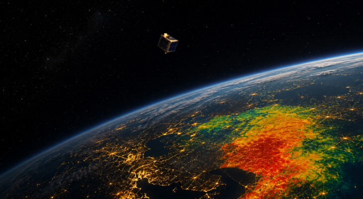
Ahmedabad-based startup SatLeo Labs plans to launch its TAPAS-1 thermal payload aboard SpaceX’s Transporter-18 mission on October 1. The device will measure land-surface temperatures from space. Co-founder Urmil Bakhai said, "TAPAS-1 is our first thermometer for the planet." This data will help farmers and cities track heatwaves and infrastructure stress.
Spacetech startup SatLeo Labs prepares to send TAPAS-1 payload into orbit aboard SpaceX's Transporter-18 and is betting that the next frontier in Earth observation will not be better pictures of the planet, but a more precise understanding of how hot it is
There is a simple way to understand what SatLeo Labs is trying to do from space: imagine giving the Earth a thermometer.
At about 11.45 pm IST on October 1, the Ahmedabad-based space startup plans to put that idea into orbit.
TAPAS-1, will be India's first dedicated commercial thermal payload, is scheduled to fly aboard SpaceX's Transporter-18 rideshare mission on a Falcon 9 from Vandenberg Space Force Base in California. The mission is being facilitated through Dhruva Space's LEAP-2 platform.
For SatLeo, however, the importance of the launch is not about adding another object to an increasingly crowded sky and more about what that object will measure.
TAPAS-1 will use thermal infrared sensing to measure land-surface temperature in the long-wave infrared band. Unlike conventional optical imaging, which depends on reflected light, thermal sensing can operate during both day and night. "We like to say our planet has a fever, and the first thing you do with a fever is measure it," says Urmil Bakhai, Co-founder and Chief Strategy Officer at SatLeo Labs. "TAPAS-1 is our first thermometer for the planet."
This means that the thermal payload could become increasingly important as heatwaves, drought, wildfires, water stress and overheating infrastructure become problems not just for climate scientists but for farmers, cities, utilities, insurers and governments.
SatLeo's pitch is that the Earth already has plenty of eyes looking down at it. What it lacks is enough high-resolution, frequently updated information about temperature.
Thermal satellite data exists today, but Bakhai says much of it is either too coarse or too infrequent for many commercial decisions. Some sources revisit a location only every 15 to 18 days, he says. That may be enough to establish a broad pattern. It is less useful when the question is whether a particular crop is under stress today, whether a power component is overheating or which neighbourhood in a city needs emergency heat measures.
TAPAS-1 is therefore designed as more than a demonstration of a sensor. SatLeo describes it as the first flight of what it calls a full-stack commercial thermal intelligence platform, combining the sensing hardware with data processing and, eventually, artificial intelligence.
This matters because the company's ambition is not ultimately to sell satellite pictures. It wants to sell answers.
Reading the Earth
The commercial Earth-observation industry has historically been built around imagery. Satellites photograph farms, cities, forests, coastlines and industrial sites, and customers then interpret those images for their own purposes.
SatLeo is trying to move one layer downstream.
A farmer may not want a thermal image. The farmer wants to know which part of a field is experiencing water stress and when irrigation should happen. A city administration may not need a temperature map for its own sake. It needs to know which neighbourhoods are becoming dangerous during a heatwave, where to place water points or shade, and when vulnerable workers should be warned.
The startup has already been testing this proposition on the ground.
In Tumakuru, Karnataka, SatLeo used satellite and drone-based thermal monitoring to study a 40-acre solid-waste landfill, identifying areas associated with methane build-up and greenhouse-gas emissions. In Ahmedabad, its work with the municipal corporation produced ward-level urban heat information and three-day forecasts. The company says those forecasts were accurate to within 2-3°C, while QR-code advisories helped outdoor workers and citizens identify heat-prone areas.
Those projects did not use TAPAS-1. SatLeo says they combined open-source satellite data, drones and IoT inputs with its own super-resolution algorithms, achieving roughly 70-75 per cent accuracy. With proprietary satellite data, it expects that to rise beyond 90-95 per cent.
TAPAS-1 is not starting with a technology looking for a problem. SatLeo is taking a problem it says it has already tested on the ground and putting its own sensing capability above it.
The first market it sees is agriculture. Heat and water stress can affect crops before the damage becomes obvious to the human eye. Thermal data could help determine when fields need irrigation, identify early signs of stress and potentially flag drought risk weeks ahead. SatLeo says agriculture companies including Cropin and BayWa have expressed interest in using the data for crop health, advisories and yield estimation.
Urban heat is another early market. As cities expand, concrete and asphalt can produce sharply different thermal conditions across relatively small distances. A citywide average temperature can conceal those variations.
The company's Ahmedabad work used 30-metre-by-30-metre pixels to map urban heat at ward level. The municipal corporation could then use those maps to determine where to deploy measures such as water points and shade, SatLeo says.
The larger opportunity is frequency. One satellite sees a place when it passes overhead. A constellation can turn that occasional observation into a stream.
Constellation is the real business
TAPAS-1 is only the opening move. SatLeo plans a constellation of roughly 12-15 satellites, with its flagship PYRO platform intended to eventually provide much more frequent thermal observations. The company says a constellation of about 15 satellites could enable roughly twice-daily revisits of any location, while AI models could fill the gaps between satellite passes.
This scenario changes the economics of the product. "One satellite cannot capture the whole globe, and customers don't buy a one-off picture; they buy a reliable feed," Bakhai says. "A constellation turns a data product into infrastructure."
SatLeo's roadmap calls for TAPAS-2 in the second quarter of 2027, its first PYRO satellite in the first quarter of 2028 and the full constellation by 2029.
The company says it has raised USD 6.1 million so far, enough to fund the next three missions. It plans to use a Series A and subsequent funding rounds to finance the broader PYRO constellation.
There is already a prospective customer base behind that plan. SatLeo says it has letters of intent (LoIs) worth about USD 52 million from seven to eight customers, with individual commitments ranging from USD 5 million to USD 10 million. Those include UAE-based Space42, Australia's Eartheye Space, agriculture companies such as BayWa and Cropin, and a large systems integrator. It has also begun pilots with energy and transmission utilities, where thermal information could be used to identify overheating components before they fail.
LoIs are not revenue, and the company's challenge will now be converting that pipeline into paying contracts once its proprietary data becomes available.
But the size of those stated commitments underlines the bet SatLeo is making: that customers will pay not for access to space imagery, but for a recurring stream of machine-readable information derived from it.
Heat has a defence market
The same technology that can tell a farmer that a field is drying out can potentially tell a defence customer something happening after dark. That is where SatLeo sees a different kind of commercial opportunity. Bakhai says agriculture will provide the company's broadest initial market, while urban heat could deliver the most visible public impact. Defence, however, could eventually generate the largest contracts.
"If things go as planned, we expect defence to account for a majority of our wallet share by the time the constellation is in place," he says, citing growing interest from India's defence and intelligence establishment in sovereign space data.
Thermal sensing has an obvious advantage in this context: it does not rely on daylight. It can detect heat signatures that conventional optical systems may not see, particularly at night.
SatLeo is deliberately vague about some of its defence discussions, saying parts of that work are classified. That leaves a crucial part of the business case untested publicly. But the company is positioning thermal intelligence as a strategic capability as much as a commercial one.
This is also why the word "sovereign" appears repeatedly in SatLeo's pitch.
Building the stack in India
The company says its advantage is not only the sensor. It is the stack.
SatLeo says it designs and builds its satellites in India and has its facility in Ahmedabad, with support from IN-SPACe and access to ISRO facilities. According to Bakhai, testing, assembly and integration facilities for a spacetech company could otherwise require an investment of Rs 15-20 crore before a startup even begins its flight programme.
This ecosystem has changed markedly in recent years, as the private-space policy has moved from a model dominated by government ownership towards one in which private companies can build, launch and operate space systems.
For SatLeo, the policy shift is part of its cost structure and has helped. "We can build our own payloads, our own satellites, and our own rockets," Bakhai says, describing India as a country with the full chain needed to build a space company.
The last part of that chain is where the October 1 launch becomes symbolically useful.
TAPAS-1 will leave Earth on an American Falcon 9 rather than an Indian launch vehicle, but the company says the mission itself has been designed and fabricated in India. The distinction shows the way the private space economy currently works: Indian startups can develop spacecraft and payloads domestically while buying launch capacity from a global rideshare market.
Transporter-18 itself is a demonstration of that new economics. SpaceX's dedicated rideshare programme allows multiple small spacecraft to share a Falcon 9, reducing the barrier to orbit for companies that cannot justify an entire launch vehicle. SpaceX says the October 1 mission will carry 130 payloads.
For SatLeo, the first launch is hence less an endpoint than a transition from laboratory validation to an operating business.
The harder problem begins after launch
Space launches have a tendency to compress years of engineering into a few minutes of spectacle.
The real test for SatLeo begins once the rocket disappears. TAPAS-1 has to show that its thermal sensing technology works in orbit, that the payload performs as expected and that the company can turn the resulting data into a usable commercial product.
That is a much harder proposition than producing an attractive image. The company wants to process data at multiple layers, including edge AI on satellites that can generate alerts in orbit and an analytics platform on the ground. Its eventual customer, Bakhai says, should ask SatLeo for a crop-stress alert, a forest-fire risk forecast or a heatwave warning rather than a satellite picture.
This places SatLeo in a growing group of space companies trying to move computation closer to the sensor and sell processed intelligence rather than raw data. Its planned PYRO satellites are intended to push that concept further. SatLeo says the platform will target sub-10-metre resolution and combine long-wave and mid-wave infrared with optical sensing. Mid-wave infrared could also provide useful visibility through haze and thin cloud, according to the company.
If the roadmap works, the competitive moat would not simply be the satellite. It would be the accumulated system around it: proprietary thermal data, algorithms trained on that data, the ability to revisit locations frequently and the customer relationships built around specific applications.