
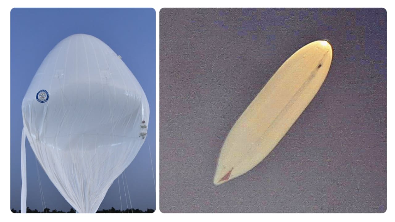
The Defence Research and Development Organisation successfully flight-tested an indigenous High-Altitude Platform at 21 km altitude. The system stayed at 20 km for over 30 minutes before a safe recovery. This surveillance platform used various electronic packages to send real-time data, marking a major step for India’s aerial defence capabilities.
Market Mastery
Webinar by Vishal Malkan
Find the weak links
in your portfolio by Vishal Malkan
The Defence Research and Development Organisation (DRDO) has successfully flight-tested an indigenously developed High-Altitude Platform (HAPS), marking a key step towards developing a long-endurance stratospheric aerial surveillance platform.
As per a PIB release, the experimental flight reached an altitude of 21 km above mean sea level (AMSL) and remained at 20 km AMSL for more than 30 minutes before being commanded to descend. The system was subsequently recovered successfully, while flight performance data was analysed.
What is a High-Altitude Platform?
The High-Altitude Platform is a lighter-than-air system being designed and developed as a long-endurance stratospheric aerial surveillance platform.
The platform is being developed by DRDO's Aerial Delivery Research and Development Establishment (ADRDE), Agra.
How did the HAPS trial perform?
During the experimental flight, the platform reached 21 km AMSL and maintained an altitude of 20 km AMSL for more than 30 minutes.
It was then commanded to descend back to the ground and was successfully recovered. The flight performance data was subsequently analysed.
Real-time video and other vehicle parameters were transmitted to the Ground Control Station throughout the flight. According to DRDO, the data showed the intended flight performance of the platform.
What systems did the platform carry?
The HAPS carried various instrumentation and control electronic packages to support its flight and monitoring.
These included:
- Inertial measurement unit
- Global Positioning System (GPS) receiver
- Onboard cameras
- Altitude control mechanism
- Other associated subsystems
The real-time video feed and vehicle parameters were acquired at the Ground Control Station during the entire flight.
Who participated in the trial?
The flight trial was conducted in coordination with several agencies, including the Indian Air Force, CEMILAC, the Directorate General of Civil Aviation (DGCA), the Airports Authority of India (AAI) and other civil authorities.
The coordination reflects the involvement of both defence and civil aviation agencies in conducting the high-altitude flight trial.
Why is the trial significant?
The successful flight trial demonstrates DRDO's progress in developing an indigenous high-altitude, long-endurance aerial platform.
The platform is being developed as a stratospheric aerial surveillance system, with the trial testing its ability to reach and maintain high altitudes while transmitting real-time flight data and video to a ground station.
Defence Minister Rajnath Singh described the successful flight trial as an important milestone in India's Aatmanirbhar Bharat journey towards developing a long-endurance stratospheric airship.
Defence Secretary, Secretary of the Department of Defence R&D and DRDO Chairman Rajesh Kumar Singh also congratulated the teams involved in the flight trial.
What comes next?
The latest trial represents a step in the development of the HAPS platform. The successful recovery of the system and analysis of flight-performance data provide inputs for the continued development of the indigenous stratospheric airship.
DRDO's ADRDE is leading the design and development of the platform, which is intended to serve as a long-endurance aerial surveillance system.